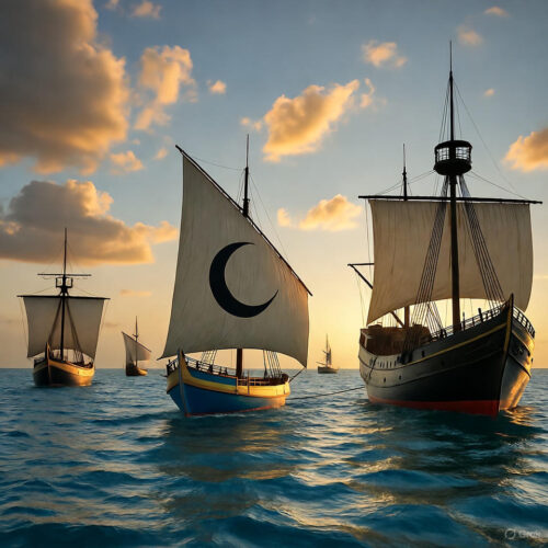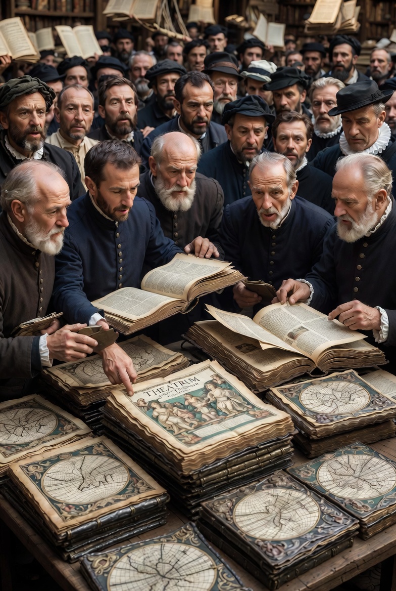
On May 22, 1570, in the bustling printing hub of Antwerp, a modest Flemish cartographer and book dealer named Abraham Ortelius released a revolutionary volume that would forever change how humanity understood its place on Earth. Titled *Theatrum Orbis Terrarum*—"Theatre of the World"—it wasn't just a collection of maps. It was the world's first modern atlas: a single, cohesive book binding together uniformly styled, detailed maps of the known world, complete with descriptive text on the reverse of each sheet. This wasn't some dusty academic tome for kings and scholars alone. It was a practical, accessible tool that synthesized the exploding geographical knowledge of the Age of Exploration into something ordinary merchants, sailors, diplomats, and curious minds could hold in their hands.Distant history? Absolutely. But its lessons echo with startling relevance in our fragmented, overwhelming modern world. In an era of GPS, satellite imagery, and endless digital noise, Ortelius reminds us of the power of curation, synthesis, and deliberate perspective. Today, we'll dive deep—overwhelmingly so—into the man, the moment, the masterpiece, and then craft a wildly unique, anti-self-help plan to apply its principles to your individual life. No generic "vision boards" or "morning routines" here. This is cartographic rebellion for the soul. ### The World Before Ortelius: Chaos, Fragments, and Medieval Muddle To appreciate the bombshell Ortelius dropped on May 22, 1570, you must understand the cartographic wilderness that preceded it. For centuries, European maps were a glorious mess. Many still clung to Ptolemy's ancient *Geographia* from the 2nd century AD, rediscovered during the Renaissance but riddled with inaccuracies as new explorations poured in from Portuguese, Spanish, and other voyagers. Maps were often bespoke, hand-drawn treasures for the elite—varying wildly in scale, projection, style, and reliability. One map might show sea monsters in the Atlantic; another, a flat Earth with Jerusalem at the center. Navigation relied on rutters (sailing directions), portolan charts for coastlines, and pure guesswork for the interiors. Antwerp in the mid-16th century was the perfect crucible. As a thriving port in the Spanish Netherlands, it pulsed with trade from the New World, spices from the East, and intellectual ferment. The printing press, pioneered by Gutenberg a century earlier, had turned the city into a publishing powerhouse. Ortelius, born Abraham Ortels (or Wortels) around April 14, 1527, fit right in. His family had roots in Augsburg, possibly fleeing religious tensions. Young Abraham lost his merchant father early and apprenticed as an engraver and map colorist. By 1547, he joined the Guild of Saint Luke as an "illuminator" of maps. He ran a shop selling books, prints, antiquities, and maps alongside his sister. Ortelius wasn't a lone genius explorer like Columbus or a mathematical virtuoso like his friend Gerardus Mercator. He was a synthesizer—a curator of chaos. He traveled extensively across Europe, building networks with scholars, merchants, and mapmakers. He collected hundreds of maps, scrutinizing them for accuracy. His breakthrough idea? Compile the best existing maps, redraw them to uniform standards (size, orientation, lettering, scale where possible), add explanatory text, and bind them into one volume organized geographically: world map first, then continents and regions. The first edition of *Theatrum Orbis Terrarum*, printed by Egidius Coppens van Diest, contained 53 maps derived from over 87 different authorities. Ortelius was meticulous about crediting sources—a rarity that built trust. The title page featured an allegorical scene with the continents as women, symbolizing the "theatre" where the world performs. Maps included decorative elements: ships, sea monsters, mermaids, and even early speculations on geography. Ortelius himself noted similarities between the coastlines of South America and Africa, hinting at ideas later formalized as continental drift and Pangaea—centuries ahead of his time.
### The Release and Immediate Impact: A Publishing Phenomenon May 22, 1570, wasn't marked by fanfare or royal decree. It was a quiet commercial launch in a city alive with ink and ambition. Yet it exploded. The atlas was expensive but became the bestseller of the late 16th century. Over Ortelius's lifetime (he died in 1598), it saw more than 30 editions and translations into Dutch, French, German, Spanish, Italian, and English. Estimates suggest over 7,300 copies circulated—a staggering reach for the era. It was updated repeatedly with new discoveries, growing to over 100 maps in later editions. Why the success? Practicality met wonder. Merchants used it for trade routes. Scholars for study. Rulers for strategy. It standardized how the world was visualized, moving away from medieval T-O maps (simple circular diagrams) toward empirical, Renaissance rationality. It influenced navigation, education, and even politics during the Dutch Revolt against Spanish rule. Ortelius was appointed royal cosmographer to Philip II of Spain in 1575, giving his work official weight. Critics and historians note its limitations—many maps still had errors, like the mythical southern continent *Terra Australis Incognita* to balance the globe. But its innovation lay in curation: not inventing new data, but organizing existing knowledge into an accessible, beautiful "theatre." This mirrored the Renaissance spirit—rediscovering classics while embracing new horizons from Magellan, da Gama, and others. Ortelius's personal life added color. He never married, lived with his sister, and maintained a vast correspondence (hundreds of letters survive). He was friends with Mercator, though their projects differed: Mercator focused on projection and a grander cosmography; Ortelius on the practical atlas. Both advanced cartography during turbulent times of religious wars, plague, and exploration. Ortelius's work humanized geography, blending science with art—maps that invited readers to "travel" vicariously.
### Deeper Details: The Maps, the Methods, the Madness of Accuracy Let's geek out on specifics, as this is 90% historical meat. The world map in the *Theatrum* used a heart-shaped projection (borrowed and refined). Europe got pride of place with detailed regional breakdowns: Spain, Italy, France, the Holy Roman Empire. Asia included the Ottoman lands and vague interiors. Africa showed the Guinea coast and Nile. The Americas were sketchier but incorporated post-Columbus data, with "Americae sive Novi Orbis" prominently featured. Each map had text on the verso: historical notes, trade goods, customs, even wildlife. For instance, descriptions of exotic animals or political structures. Ortelius cross-referenced sources rigorously. He used copperplate engraving for durability and detail, with hand-coloring options for premium copies. Later editions added maps of the Pacific, more accurate Japan, and Arctic regions. The cultural ripple: It democratized knowledge. No longer did you need a library of disparate charts. One book sufficed. It fueled further exploration by clarifying gaps. It shaped European identity during the shift from medieval to modern worldview. In classrooms and courts, it became a status symbol and tool. Its influence persisted into the 17th century, inspiring atlases by Blaeu and others. Today, original copies fetch fortunes at auctions; facsimiles grace libraries worldwide. Ortelius died on June 28, 1598, in Antwerp, buried in the church of St. Michael's Abbey. His legacy? The atlas format we still use. Google Earth is his distant digital descendant. He proved that in chaotic times, the person who maps the fragments wins.
### From 1570 to Your Life: The Cartographic Rebellion Plan History without application is mere trivia. Ortelius didn't just draw maps—he *curated reality*. In today's info-overload (social media scrolls, career options, news cycles, personal data), we drown in fragments. His method offers a radical antidote: deliberate synthesis into your personal "Theatrum Vitae"—Theatre of Your Life. This isn't another productivity hack. It's a unique, almost subversive framework: treat your existence as an atlas to author, edit, and expand. No affirmations. No hustle culture. Just cartographic discipline with humor, wonder, and steel. **Specific Bullet-Point Benefits You Gain Today:** - **Clarity Amid Chaos:** Like Ortelius standardizing mismatched maps, you'll reduce decision paralysis by curating your "known world" of goals, relationships, and skills into consistent, usable formats—leading to faster, regret-free choices. - **Synthesis Superpower:** Stop consuming passively. Actively compile disparate life data (habits, finances, knowledge) like he did sources, revealing hidden connections and opportunities others miss. - **Perspective Expansion:** His atlas grew with new data. You'll build resilience by regularly "updating" your mental maps, turning setbacks into new territories to explore. - **Legacy Building:** One volume influenced centuries. Your personal atlas becomes a living document—shareable with family or mentees—creating impact beyond your lifetime. - **Joy in Curation:** Maps had monsters and mermaids. Infuse wonder into the mundane, making daily life an adventure rather than a grind. - **Strategic Edge:** In career or personal conflicts, visualize "terrain" like battle maps, outmaneuvering obstacles with foresight. - **Intellectual Humility:** Crediting sources taught accuracy. You'll own mistakes, iterate faster, and build authentic expertise. **Your Unique "Ortelius Atlas Protocol" – A 90-Day Cartographic Life Overhaul (Not Self-Help, Self-Mapping)** This plan is anti-formula. It's iterative, visual, and irreverent—like redrawing a flawed map mid-voyage. Commit to physical or digital notebooks mimicking 16th-century style: parchment-feel paper, ink pens, hand-drawn elements. No apps first—tactile for depth. Do it solo or with a small "guild" of trusted allies. Humor mandatory: name flawed maps after sea monsters.
-
**Week 1-2: The Grand Survey (Gather Raw Data Like Ortelius's Collection)**
Audit your current "world." List every domain: Career Terrain, Relationship Archipelago, Health Continents, Finance Oceans, Knowledge Unknowns, Joy Islands. For each, dump unfiltered data—successes, failures, random facts, dreams, fears. Use messy sketches. Add "monsters" for uncertainties (e.g., "Debt Kraken"). Goal: 50+ raw "maps." Funny rule: Exaggerate one entry absurdly (e.g., "My cooking skills = mythical Eldorado of flavor").
-
**Week 3-4: Uniform Standardization (Redraw for Consistency)**
Choose one visual language: colors (blue for calm, red for urgent), icons (anchors for stability), scale (1-10 impact). Redraw top 10 priorities uniformly. For example, a "Career Map" with routes (daily actions), hazards (toxic boss), treasures (skills). Cross-reference like he did—link "Health Map" to "Energy for Career." Burn or delete inconsistent old versions symbolically.
-
**Week 5-6: Add Descriptive Text (Narrate Your Realities)**
On the back of each map, write vivid prose: history of that domain, customs (habits), trade goods (what you offer/gain), future projections. Be brutally honest yet motivational. Include "explorations" section for experiments. Example: "In Finance Ocean, currents favor side hustle; beware Siren Subscription Traps."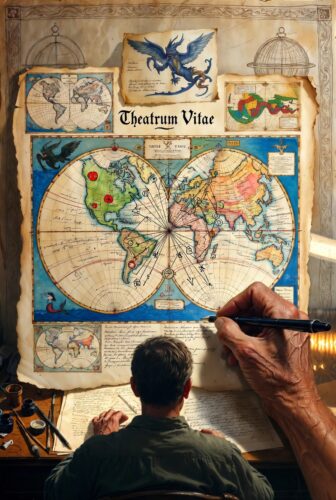
-
**Week 7-8: The Binding and Expansion (Synthesize into Master Atlas)**
Compile into one "volume"—physical binder or secure digital. Add a world overview map: Your overarching life vision with interconnected regions. Identify gaps (new "discoveries" to pursue). Update weekly like later editions. Share select pages with mentors for feedback, crediting their input.
-
**Ongoing: Voyages and Revisions (Iterate Like 30+ Editions)**
   Quarterly "expeditions": Test one new territory (skill, relationship, habit). Measure, redraw. Celebrate with "theatre" performances—tell stories from your atlas to friends. If life throws a "storm" (job loss), map it immediately as new land. Unique twist: Include "Pangaea Moments"—force connections between unrelated domains (e.g., link cooking hobby to networking).


**Daily Micro-Ritual (5-10 Minutes):** "Deck Watch"—glance at one map, adjust one element. Motivational fuel: Recall Ortelius turning chaos into bestseller. Laugh at outdated maps. This builds unbreakable directional intuition.


This protocol stands apart because it's not about becoming "better"—it's about authoring your world's representation so thoroughly that external chaos loses power. Ortelius didn't conquer the globe; he framed it. You won't conquer life; you'll stage its grand theatre on your terms.


In 1570, one man in Antwerp handed humanity a mirror to see itself more clearly. On this anniversary of May 22, pick up your quill—metaphorical or literal. Map boldly. The world awaits your *Theatrum*. Your future self, sailing smoother seas, will thank you.
Share: